Search Term Record
Metadata
Name |
Little Harbor |
Related Records
-
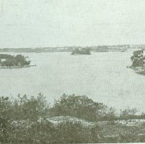
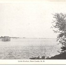
2006.001.335 - Print, photographic
Post card picture of inland waters, New Castle.
Record Type: Photo
-
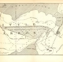
2006.001.643 - Documents
Includes photographs of Fort Stark, letters, a map, an article from NH Profiles, and a history or Fort Stark. Includes 1887 map of Little Harbor breakwater project. (PDF of map saved on NCHS computer.)
Record Type: Archive
-
2006.001.700 - Documents
An article by J. M. Moses titles "Pioneers of Little Harbor and Vicinity", printed in "The Granite Monthly: A New Hampshire Magazine" in July, 1914.
Record Type: Archive

-
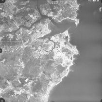
2006.001.710 - Print, photographic
Aerial view of Rye, Little Harbor, and part of New Castle.
Record Type: Photo
-
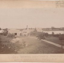
2006.004.04 - Print, Photographic
Gov. Benning Wentworth Mansion, Little Harbor Road, Portsmouth,N.H.
Record Type: Photo
-
2009.061 - Documents
Photocopy of a typed manuscript by Fred White on the occassion of the Tricentennial in 1993 titled: "Chronological List of Events in the History of New Castle." People, events and locations are noted in the People and Search Terms fields.
Record Type: Archive
-
2012.008 - Print, Photographic
A collection of old New Castle postcards on CD, labeled Ruthie Lanham Collection. This record contains 166 images of 83 postcards, front and back.
Record Type: Photo
-
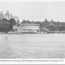
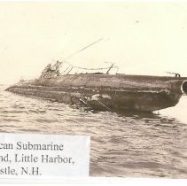
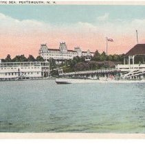
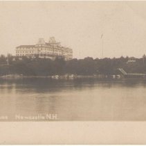
2012.008.073 - Postcard
Wentworth by the Sea and the Ship from Little Harbor, New Castle, N.H.
Record Type: Photo
-
-
-
-
-
2015.005 - Map
Preliminary Chart of Portsmouth Harbor, New Hampshire, 1854, from a Trigonometrical Survey under the direction of A.D. Bache, Superintendent of the Survey of the Coast of the United States. Triangulation by Capt. T.J. Cram, U.S. Topl. Engrs. Asst. U.S.C.S. Topography by Capt. H. Stansbury, U.S. Topl.Engrs. Hydrography by the Party under the command of Lieut. Comd. . Woodhull, U.S. Navy Asst. Includes Sailing Directions, Dangers, Tides, and ...
Record Type: Archive
-
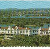
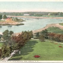
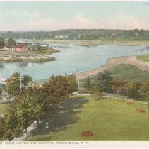
2015.017.41 - Postcard, Picture
Looking west from Hotel Wentworth, Newcastle, N.H. Color tint
Record Type: Photo
-
-
-
-
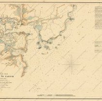
2017.005.01 - Map
Portsmouth Harbor, New Hampshire, 1866; edition of 1876. Triangulation by Capt. T.J. Cram, U.S.Topl. Engrs. in 1850 & 1851. The Topography and Hydrograpy of the harbor and environs are from the survey by Capt. H. Stansbury, U.S. Topl. Engrs. and were executed between the years 1842 and 1846. The approaches to the harbor are from the survey by Lieut. Comdg. M. Woodhull, U.S. N. in 1851 and the Topography and Hydrography souht from Pulpit Rock Po...
Record Type: Archive
-
-